Trade Routes to Ambergris Caye
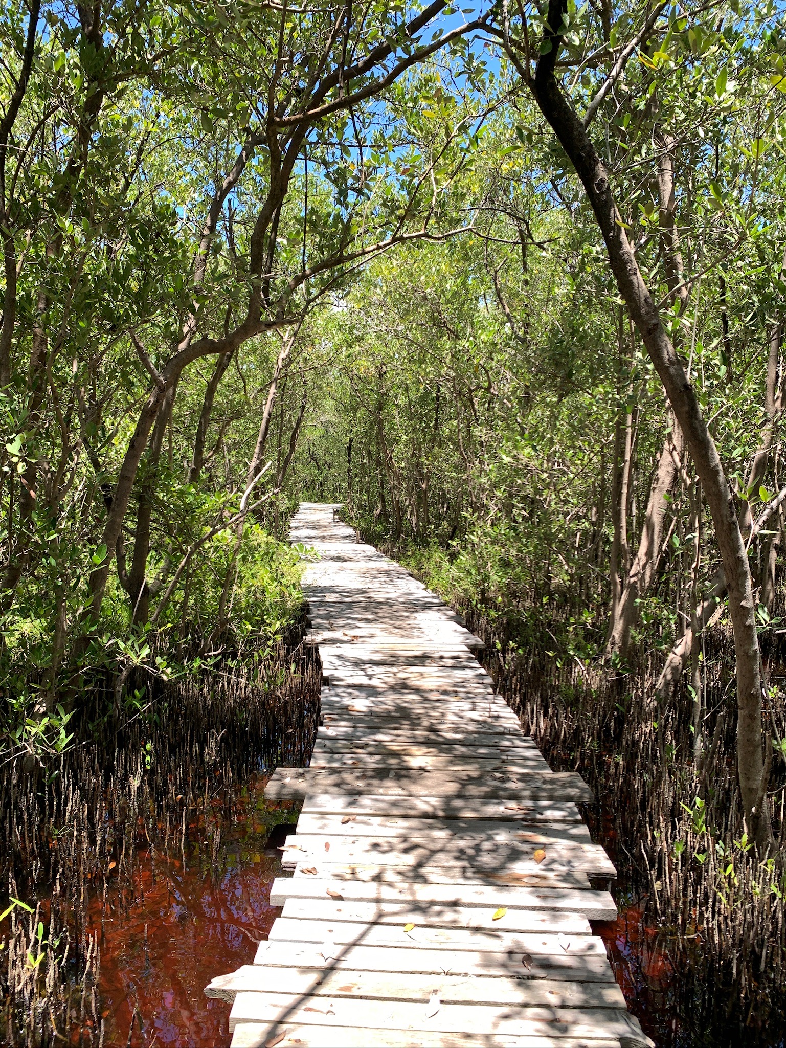 The walk to Marco Gonzalez
Whether you are visiting the site of Marco Gonzalez for the first time or the hundredth, welcome!
Marco Gonzalez is the largest Maya site on Ambergris Caye and was first excavated in 1986. This initial excavation preluded several additional years of research. The excavations conducted during these seasons have found that the site was occupied as early as the Late Preclassic period and extended to the Middle Postclassic period. The table below shows the dates associated with Marco Gonzalez.
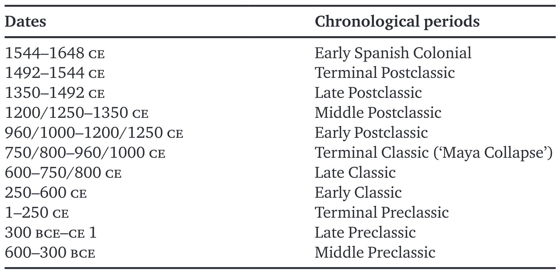 Table 1 - Chronology of Marco Gonzalez
One time period that may have caught your attention in the table is during the Terminal Classic, which coincides with an event known as the "Maya Collapse." However, this name is a little bit of a misnomer - while some sites were abandoned, the Maya civilization did not "collapse." Rather, this was a period of social and environmental change, with population movement and a decentralization of political and economic power.
Marco Gonzalez served as the island’s largest trade port, providing an economic foundation that may have been the key to its long-term sustainability. Previous research has indicated that the site not only survived, but also thrived during the Terminal Classic and Early Postclassic. The role of Marco Gonzalez as a major trading hub placed them in direct contact with several communities along the coast, rivers, and islands throughout the Caribbean. Access to these waterways would have allowed the community to access food and trade goods.
As you walk to the site, you can see that the site is surrounded by mangroves. These mangroves began appearing in the Postclassic period, and may have played a role in the Marco Gonzalez community moving out of the area and over to San Pedro.
This website, "Trade Routes to Ambergris Caye" is a digital cultural heritage mobile website created to engage tourists and local communitites with ongoing research at Marco Gonzalez. This website will be updated after each field season, as well as when research from Marco Gonzalez is published!
What is the Marco Gonzalez Archaeological Project?
After a several year hiatus, excavations at Marco Gonzalez resumed the summer of 2023. The first undergraduate archaeological field school was held this same summer, as a part of the Marco Gonzalez Archaeological Project (MGAP).
The field school consisted of undergraduate students from Michigan State University, University of Michigan-Flint, University of Belize, and Galen University (in Belize).
One of the interesting finds that we had in 2023 was Burial 14/40. This burial was of an individual who was positioned face-up, with his legs in a cross-legged position in the northeast quadrant of Structure 14. It was determined that the individual was a young male. He had grave goods with him, including shell ear spools, two obsidian bladelets, a gourd-shaped ceramic vessel, two orange polychrome vessels, a bone needle, two conch shell ink pots, a writing stylish made of bird bone, and several ceramic sherds.
Because of the grave goods that were buried with him, we believe that he may have been a scribe.
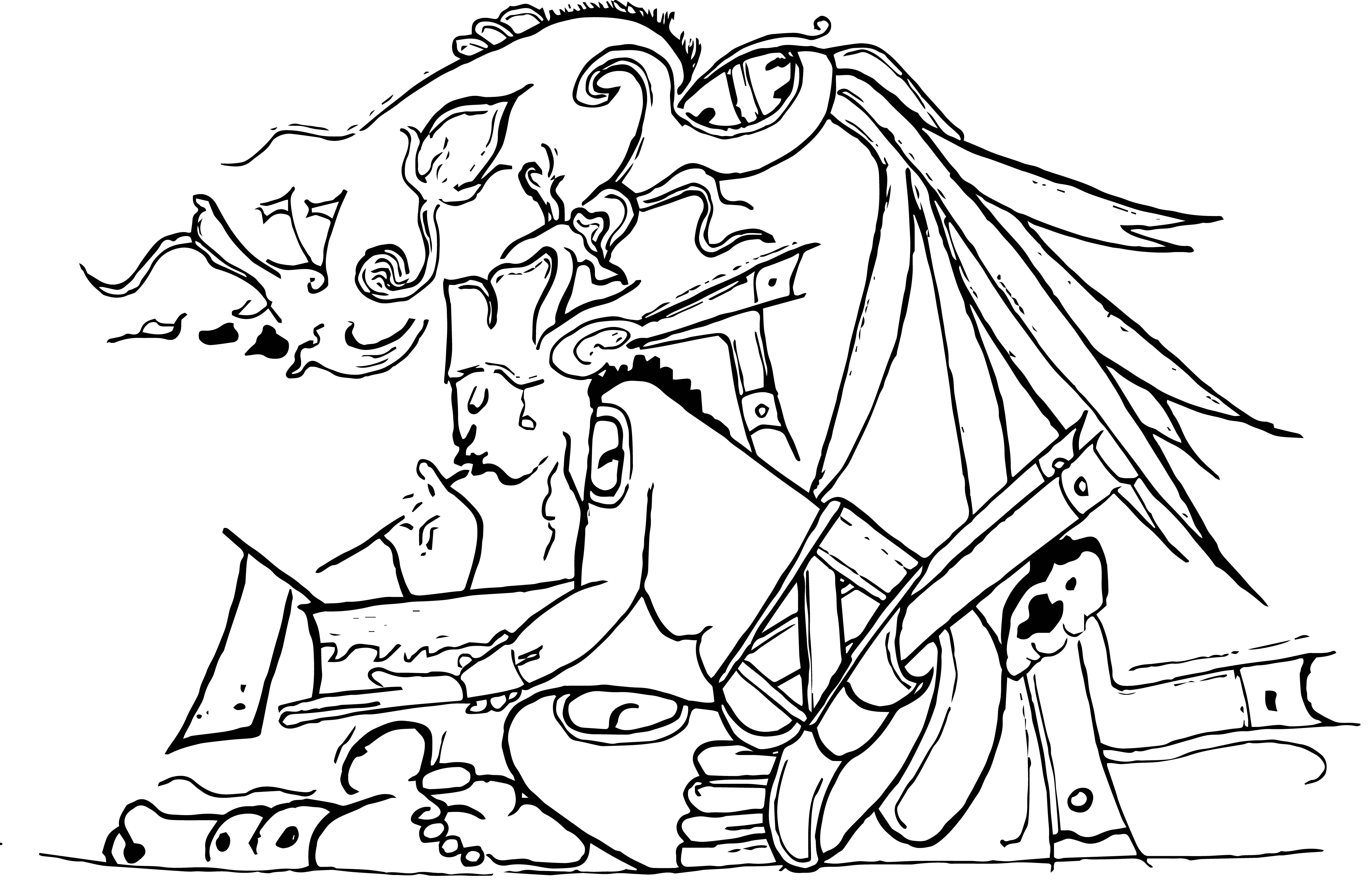 The 2023 MGAP field school scribe logo design
And that's how we got the above logo of a Maya scribe writing!
MGAP will be continuing each year for the foreseeable future. We are currently ramping up for the 2024 field season and are very excited to be back onsite!
Come back to keep up with our findings!
 The 2023 MGAP field school group photo
How to Navigate This Site
There are 5 pages that you can explore to learn more about Marco Gonzalez and it's place within broader Mesoamerica. Those tabs are:
The first tab on the navigation bar, titled "Introduction", will take you back to this page.
The second tab on the navigation bar, titled "Mesoamerica Map", will take you to a Leaflet map that encompasses the Mesoamerican region (Mexico, Belize, Guatemala, El Salvador, and Honduras). Pins on the map will indicate locations that are connected to Marco Gonzalez, as discovered through artifact analysis.
The third tab on the navigation bar, titled "Marco Gonzalez Map", will take you to a georeferenced map that show the archaeological map of Marco Gonzalez structures; this will allow visitors to identify the structures while on site. Pins on the map will indicate where particular artifacts were found - more specifically, the artifacts that traveled to Marco Gonzalez.
The fourth tab on the navigation bar, titled "Contact", will take you to a contact page where you can contact Aubree S. Marshall, the creator of this project.